01 / Define
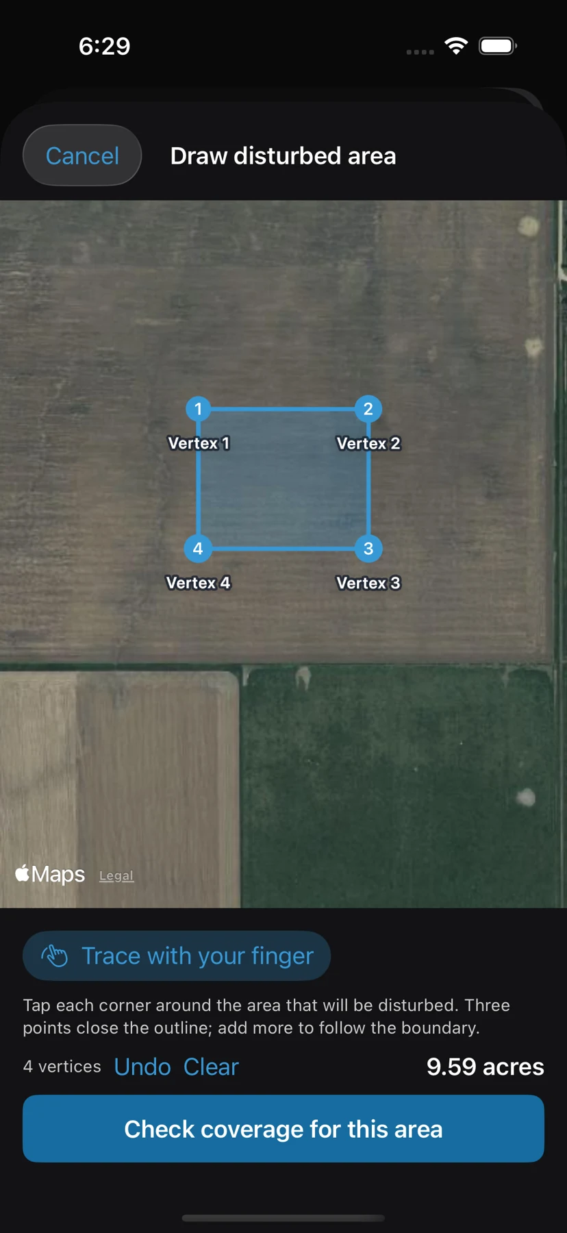
Tap the boundary points.
Outline the actual limits of disturbance or import site geometry. Review estimated acreage, jurisdiction and common-plan facts before choosing a permit route.
Construction stormwater · iPhone & iPad
 StormCheck
Draw the disturbed area. Review coverage facts. Keep plans, observations, photos and corrective actions with the project as it changes.
Preview · App Store release in preparation. Availability and pricing have not been announced. Ask about StormCheck.
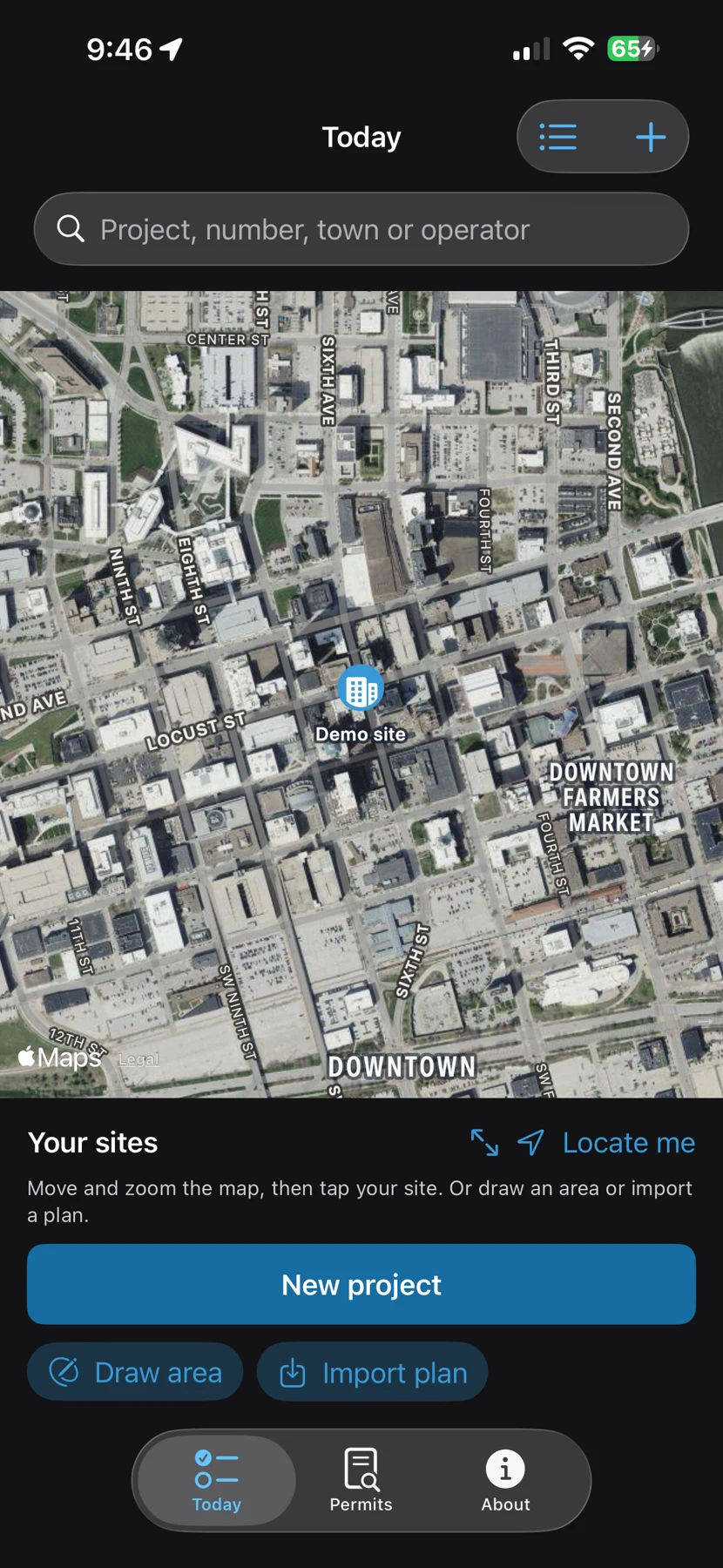
Actual StormCheck screen · demonstration project
One project, a continuing record
Outline the actual limits of disturbance or import site geometry. Review estimated acreage, jurisdiction and common-plan facts before choosing a permit route.
Start or resume a visit from the site pin. Record control conditions, photos, locations and notes, then review the missing items before signing.
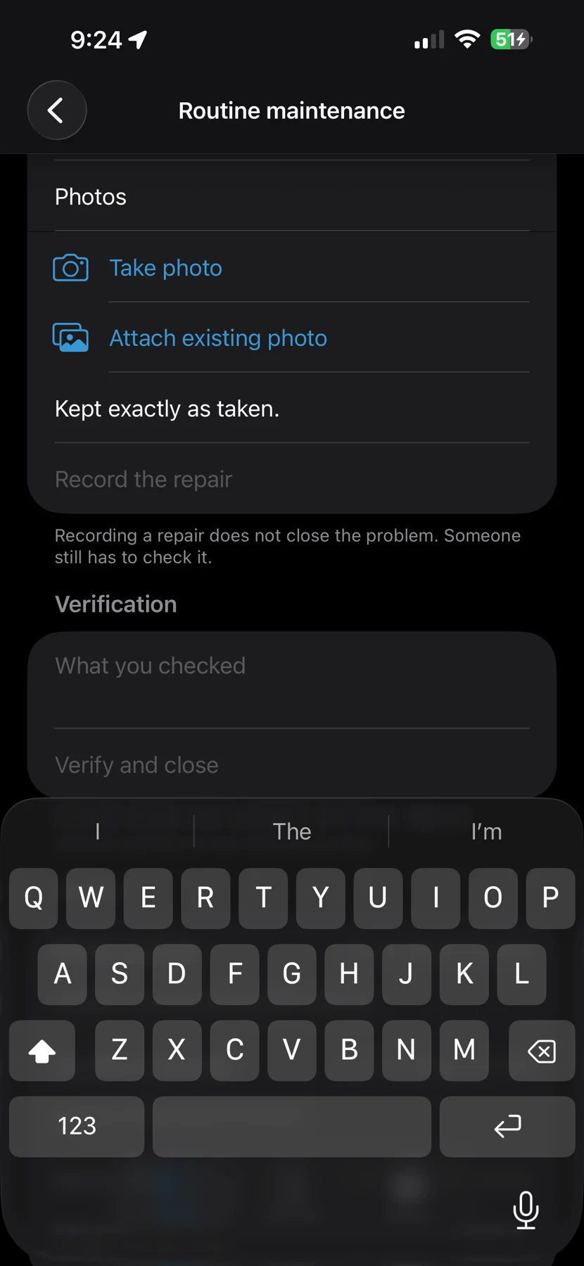
Keep document versions, saved edits, inspection evidence, repairs, verification and signed report amendments in the project history.
See the actual workflow
Tap a screenshot to open it at a larger size.
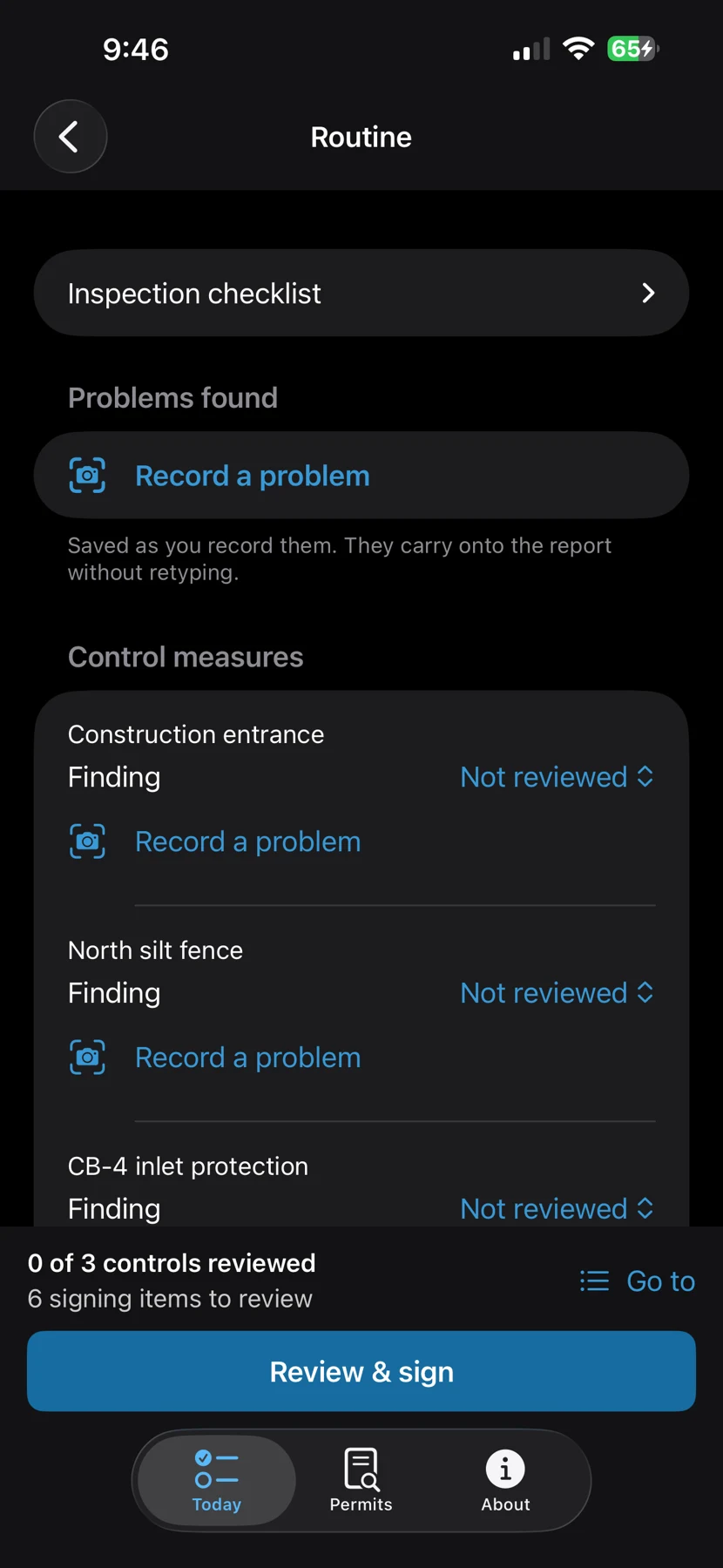
Bring the plan into the record
Import site geometry from supported geospatial files. Attach PDF plans, images and scanned text; review on-device OCR proposals before approving project facts or requirements.
Confirm geometry, projection and units after import. Scanned plans do not automatically become georeferenced boundaries. Export DWG to a supported format first.
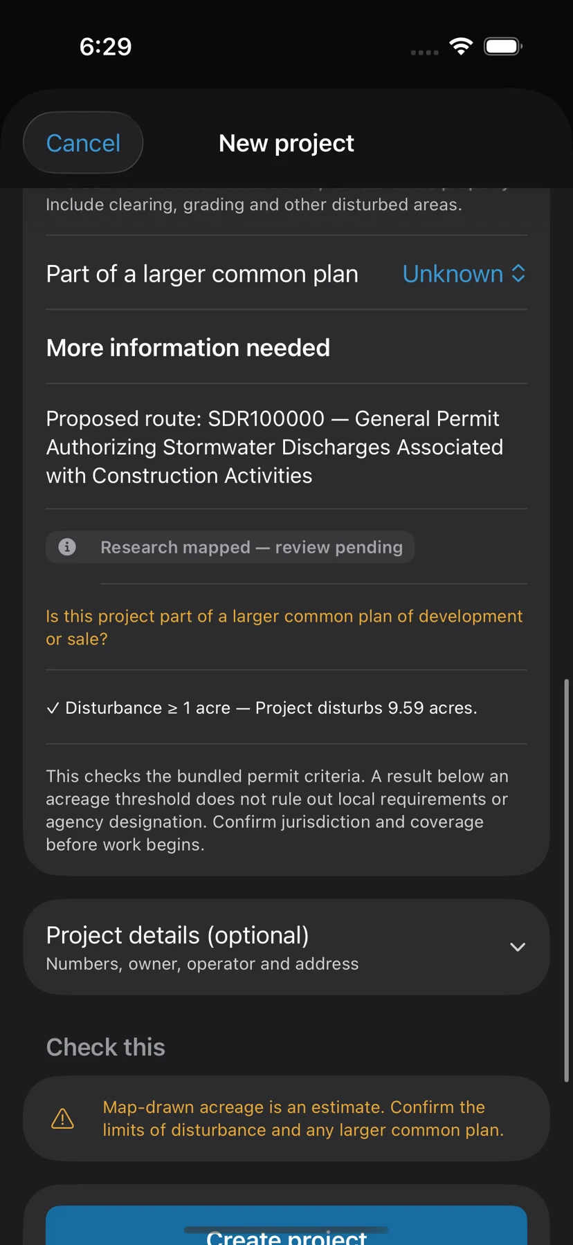
StormCheck screens entered facts against bundled permit criteria. Research-mapped packages are pending qualified review. The app does not issue a permit or independently certify compliance.
A small site is not automatically exempt. Confirm common-plan acreage, local requirements, agency designation and the actual governing documents.
Read the coverage lesson →Free illustrated training
The 14-page manual includes actual app screenshots, practical steps and checks for project setup, imports, inspections, evidence, weather, signing, repairs, history and backup.
Version 1.0 preview · Updated 14 October 2026 · PDF and accessible HTML · No sign-up
Project records, inspections and history stay available on the device without an account. Fresh maps and weather need connectivity. Optional nearby weather is off by default.
The first release uses exports for sharing and backup. Keep a separate verified copy of your project; automatic team/cloud synchronization is not included in this release.
Local project records, bundled rules, inspection drafts, history and reports remain available offline. Fresh map imagery and station weather require connectivity or available cached data. Keep approved documents and a verified backup available for the visit.
No. Record the corrective action and then verify the repair separately. Signing preserves the inspection record; open issues retain their own lifecycle and follow-up.
The App Store release uses project exports for sharing and backup. Automatic team/cloud synchronization is not included. Review the exported record and its attachments before handing it over.
The first release is in preparation. Availability and pricing have not been announced. You can review the workflow and training material now or contact PurposeBuilt about a preview.