DTCD
Stop Doing
Paperwork.
Start Getting
Paid.
DTCD replaces clipboards, separate apps, and hours assembling PDFs — with one app your crews already know how to use.
Built for contractors. Useful to DOTs. Ready for real-time work zone data.
Nearly Every State DOT Already Requires Daily Traffic-Control Records
A 50-state review found that nearly every state DOT requires some form of daily traffic-control record. The names — and how strongly each is spec-bound — differ: diary, daily inspection report, work-zone checklist, device record, project diary, logbook, daily work report. The underlying need is the same.
DTCD generates the right output for your state automatically. Tap any state below to see its specific form.
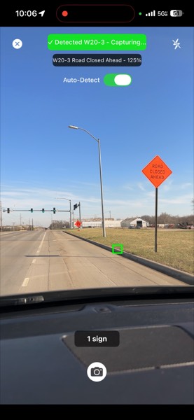
Drive Through
AI-assisted MUTCD sign detection during drive-through capture, where safe and appropriate. Designed for daytime and low-light use. Decision-support only — verify all output.
App Does The Rest
GPS, lane config and closure type auto-fill from sign detection.
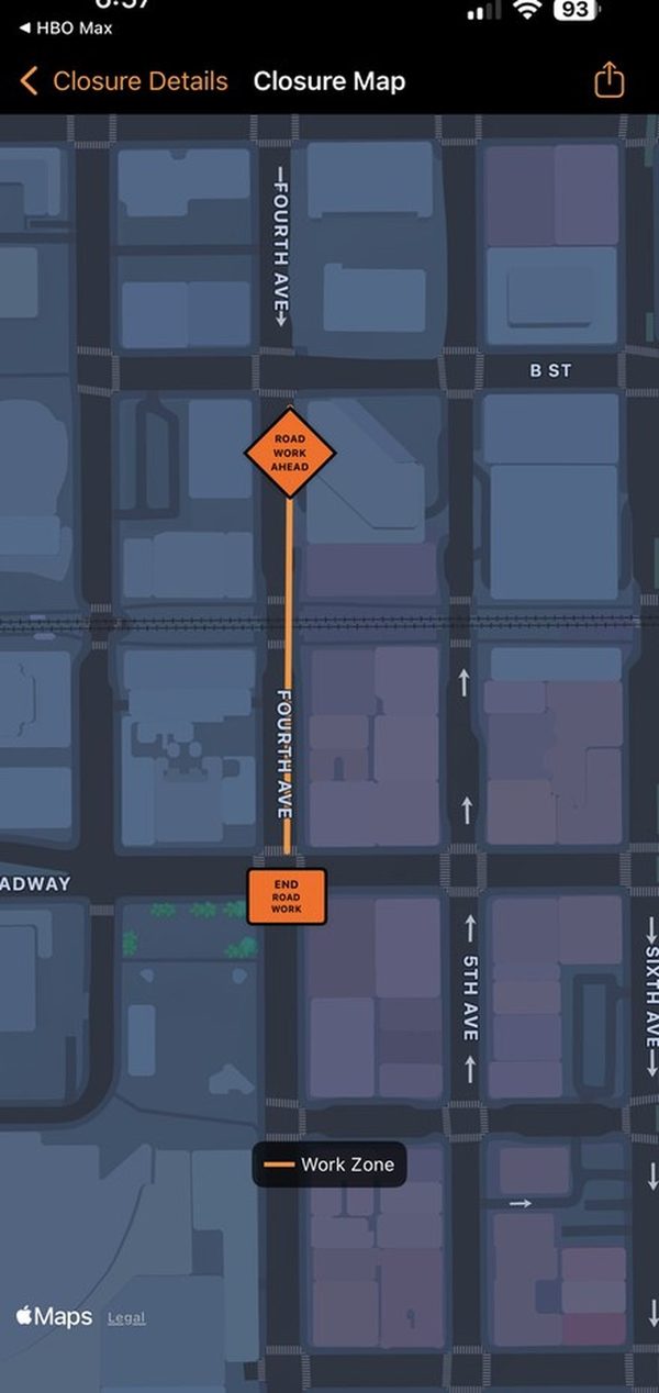
Instant PDF Diary
Map, photos, hours & entries generated in seconds. Submit or invoice.
Auto-Capture Sign Detection
AI-assisted MUTCD sign detection during drive-through capture. Decision-support only — verify all output.
GPS-Tagged Photos
Every photo GPS-stamped, timestamped & cloud-synced.
PDF Diary Generation
Road-snapped map, GPS photos, logs & daily entries — instant PDF.
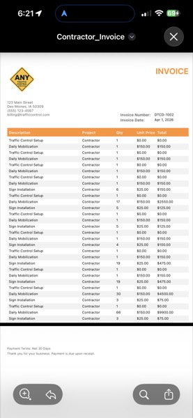
Auto-Generated Invoice
Line items from closure data — no spreadsheets, no double-entry.
AI Safety Alerts
Photos analyzed for non-compliant setups — alerts sent to DOT.
See all features
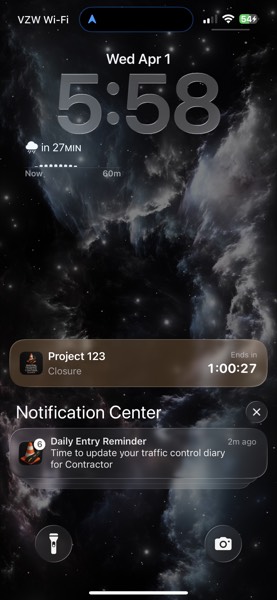
Lock Screen Countdown
Live timer on lock screen & Dynamic Island.
Personnel & Cert Tracking
Hours auto-calculated. ATSSA, IMSA, OSHA expiry alerts.
WZDx 4.2 & CWZ 1.0 Compliant
Public data feed available · API endpoints on request · Customization options.
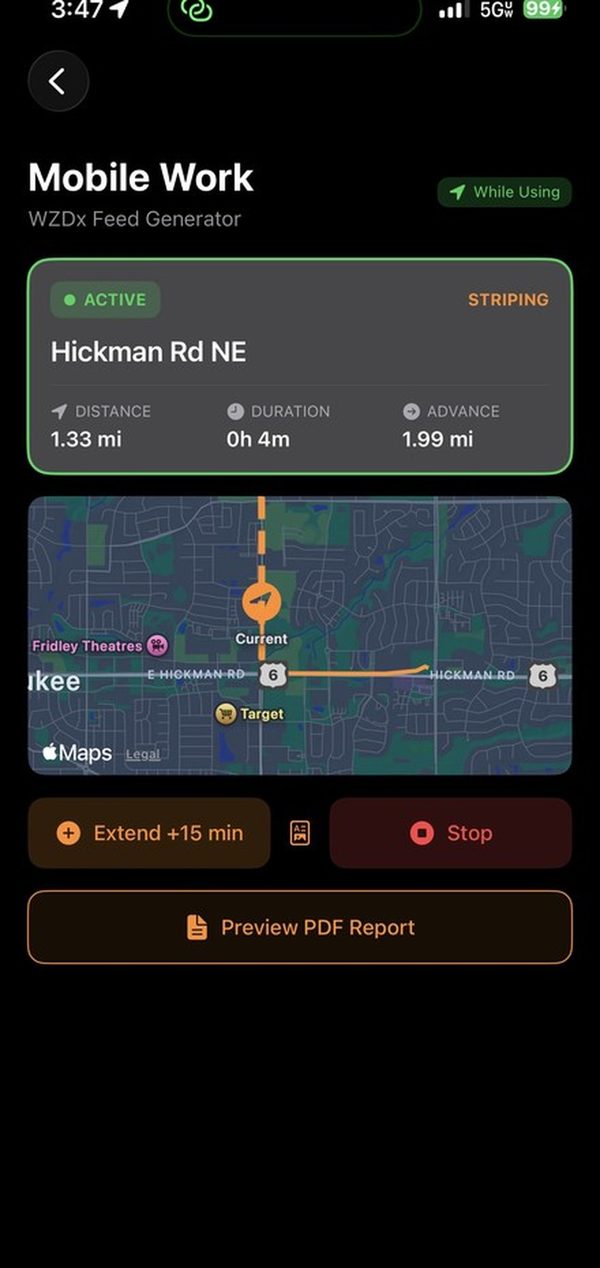
Mobile Work Zone Tracking
Live WZDx feed moves with striping & mowing crews.
Multi-Format Export
WZDx, KML, and invoice-ready data — one tap from any closure.
Agency Messaging
Two-way communication with DOT inspectors built into every closure. Send and receive messages from the field — no phone tag, no email chains.