01 · DEFINE
Mark the occupied work area.
Pick the start and end, draw a work footprint or import an alignment. Choose the work type and check the roadway inputs. The approach signs and tapers sit outside the work area.
Turn your work area into a mapped traffic-control draft. Keep road geometry, satellite landmarks and measurements on the page your reviewer sees.
Already subscribe? Sign in with the same DTCD account. Free county accounts do not include the planner.
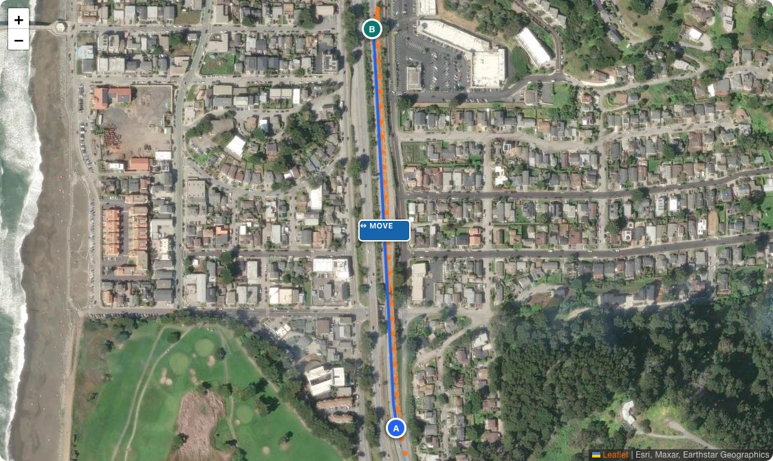
Put the work on the road once. Plan Studio uses the available alignment to place the layout and its measurements, while keeping missing inputs and review issues visible. You can adjust the design rather than rebuilding the same road in a separate drawing.
Pick the start and end, draw a work footprint or import an alignment. Choose the work type and check the roadway inputs. The approach signs and tapers sit outside the work area.
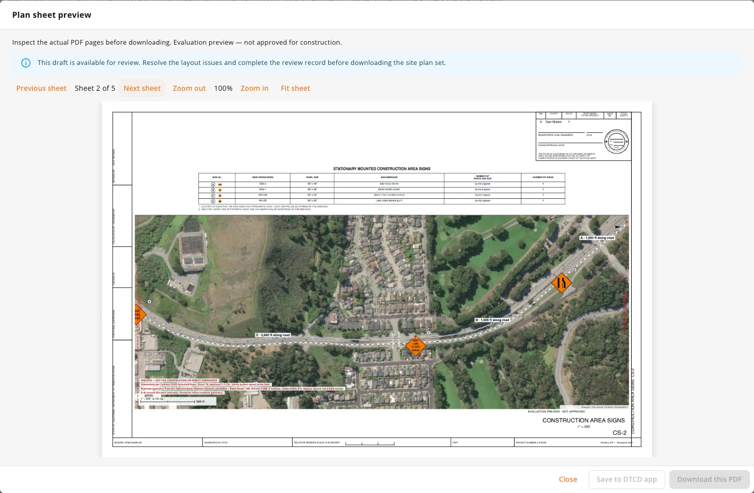
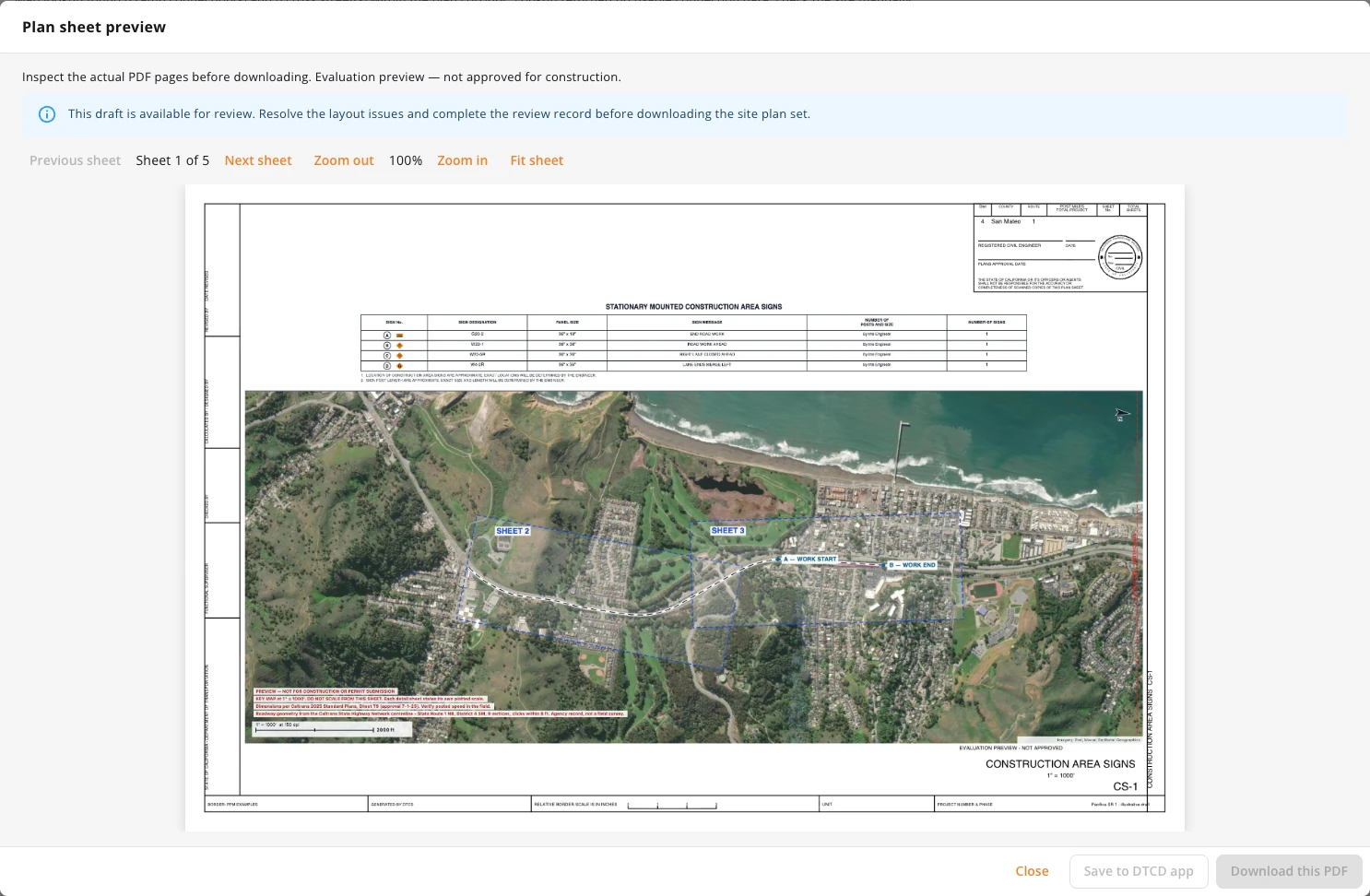
Inspect the PDF before downloading. Follow the road, identify nearby landmarks and review along-road dimensions, device locations and the sign schedule.
Export location-aware PDFs, a Google Earth KMZ or a geographic CAD package. Save a reviewed draft to its closure and choose which account-linked crew members can access it.
The satellite-backed sheets show the corridor, warning signs and distances along the alignment. The map gives reviewers the landmarks a straight schematic cannot.
Long corridors use an overview and detailed sheets. Schematic diagrams remain supporting pages and are clearly identified as having no map.
Illustrative Pacifica SR 1 example using Caltrans roadway geometry. Speed, lane width and closure inputs are demo assumptions—not field measurements or an approved design.
Plan Studio is included with Small Regional, Large Regional, Statewide and Nationwide dashboard plans, assigned App Seats, and active iOS/Android Pro subscriptions linked to the same account.
Free county accounts can use the public dashboard features. Photo/AI and V2X add-ons alone do not unlock Plan Studio.
An account alone does not unlock the planner. Choose a qualifying subscription after signing in, or use your existing linked purchase.
No. Plan Studio reduces layout preparation and handoff work. Drafts still require site verification, applicable agency review and a professional engineer’s seal where required. Generated outputs are labeled evaluation previews.
The planner supports national roadway context and a federal MUTCD baseline, with state-specific sources where implemented. Native standards and available arrangements vary by jurisdiction. Review the governing requirements and unresolved details for each site.
Sign in with the same account used for your mobile purchase. Active production Pro subscriptions and assigned App Seats qualify. If a purchase is not linked, use the dashboard’s account restoration options.
New shared plans are private to their uploader and selected account-linked crew members. Removing a member’s closure assignment revokes server access. Previously downloaded or offline copies cannot be recalled.
Yes. Import an alignment or work-area file, confirm its coordinate system and check the geometry against field evidence. Satellite imagery supplies context; it is not a survey.